AVLOKAN · ENTERPRISE WEB GIS PLATFORM
Location intelligence for land, assets and cities
One platform from drone flight to final decision.
Avlokan is Enercomp's enterprise web GIS platform. Bring drone surveys, satellite imagery, cadastral maps, CAD drawings and field records into one secure, browser-based workspace.
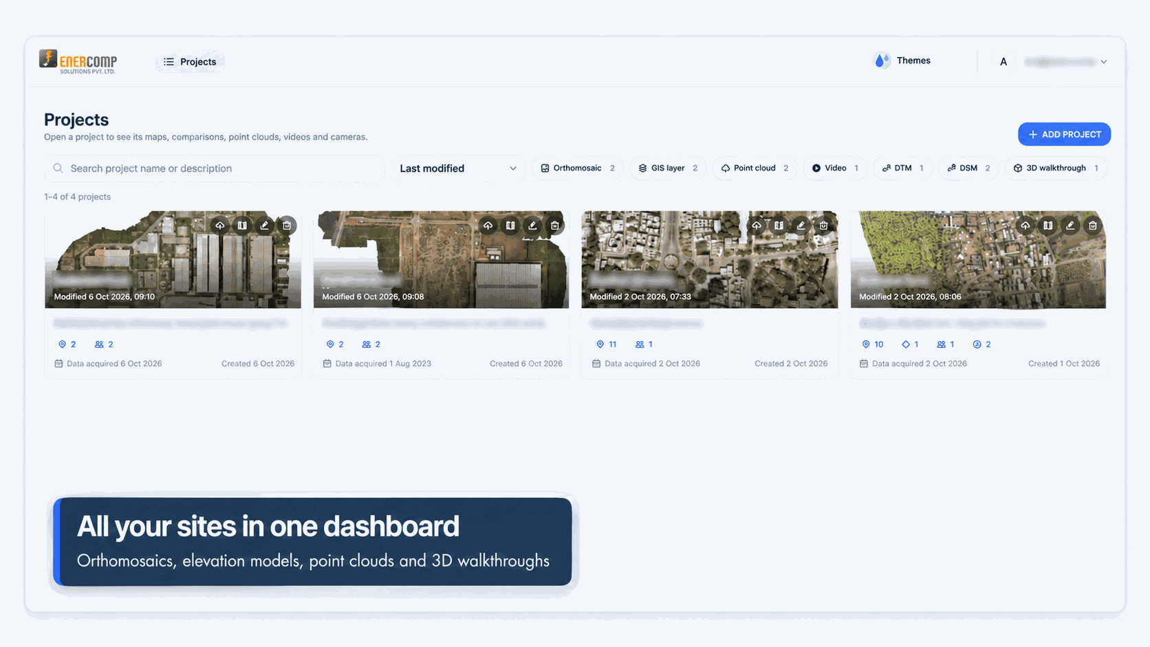
INTRODUCING AVLOKAN
One platform from drone flight to final decision
Avlokan is a browser-based GIS for organisations that manage land, infrastructure and territory.
It works with imagery and elevation data produced by drones and satellites and puts it in the hands of field surveyors, GIS analysts, approving officers, senior management and, where appropriate, citizens.
Land measurements handled
Measurement requests processed every month
Villages mapped and digitised under SVAMITVA
Protected monuments documented in 3D
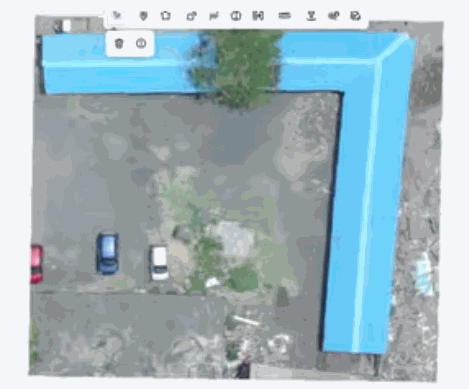
ORTHOMOSAICS
Drone maps in the browser
Work on your own high-resolution orthomosaics, no desktop GIS
DRONE TO DECISION
From raw survey data to actionable intelligence
Capture
Drone, LiDAR, DGPS, satellite and legacy map data.
Process
Orthomosaics, DEM/DSM, contours, point clouds and 3D meshes.
Publish
Tiled layers on GeoServer with PostGIS behind them.
Work
Digitise, measure, edit, ground-truth and approve.
Decide
Dashboards, reports, change detection and AI insights.
BUILT FOR
Location intelligence across sectors
Land Records & Revenue
E-measurement, parcel digitisation, survey approvals and citizen portals.
Urban Local Bodies
Property mapping, flood planning, encroachment and change monitoring.
Archaeology & Heritage
3D documentation, protected and regulated zones and drawing archives.
Ports & Infrastructure
Asset digitisation, construction progress and compliance.
Water, Forest & Agriculture
Reservoir capacity, resource mapping and crop assessment.
Construction & Mining
Progress monitoring, stockpile volumes and terrain change.
WHY AVLOKAN
Eight capabilities built around real field work
Drone-native
Handles GeoTIFF orthomosaics, DEMs, DSMs, contours and point clouds.
Proven at state scale
Built on the foundation supporting large-scale land measurement operations.
No licence lock-in
Open-source stack with no recurring per-user or per-server licence fees.
Online & Offline
Continue working without connectivity and synchronise later.
Workflow Built In
Maker-checker approval, audit trails and publish controls.
Speaks Your Language
Local-language forms and labels, including Marathi.
Secure by Design
Role-based access, SSO, MFA, encrypted transport and activity logs.
Configured, Not Rebuilt
Configure layers, roles, forms, dashboards and print layouts.
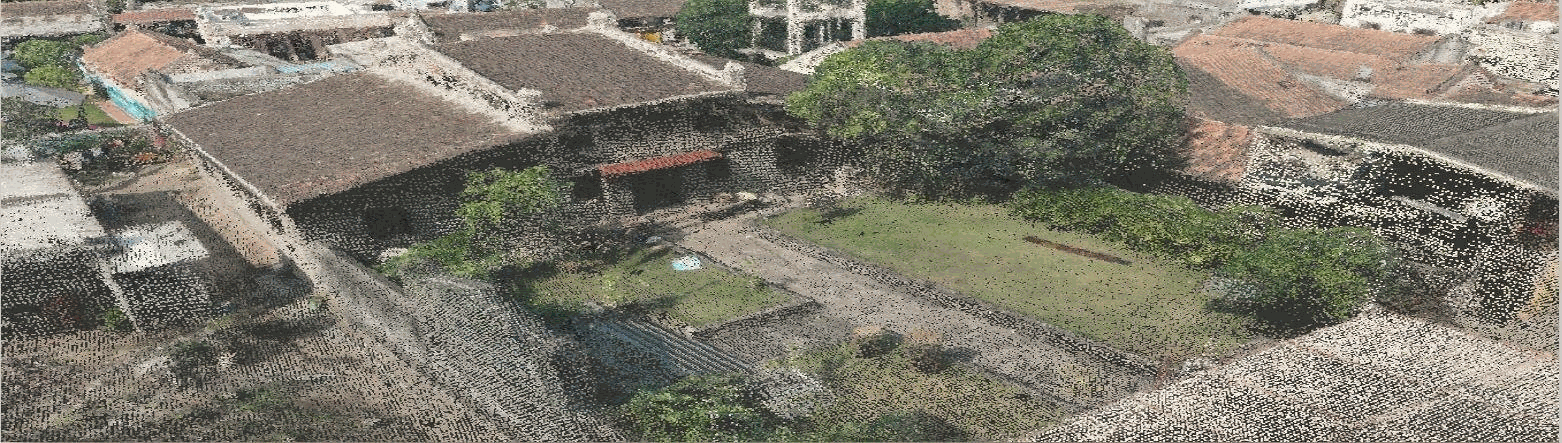
Drone Orthomosaic of a Heritage Site
PLATFORM ARCHITECTURE
Open, scalable and standards-based
Avlokan uses a classic three-tier architecture designed for enterprise deployment, audit and scale.
Angular · Nebular · HTML5 · OpenLayers
Java · Spring · Hibernate · REST · SOAP
PostgreSQL · PostGIS · GeoServer
TensorFlow · scikit-learn · OpenCV
FEATURE TOUR
A map that does the work
Explore
Zoom, pan, identify and query features. Search by address, coordinates, place names or attributes.
Layer Control
Switch raster and vector layers, set transparency and toggle base maps.
Overlay & Annotate
Add markers, annotations and shareable bookmarks.
Drawing
Point, line, polygon, rectangle and hole-in-polygon drawing.
Modify
Edit vertices, transform, resize, split and merge.
Measure
Distance and area measurement in required units.
Export
PDF, CSV, Excel, Shapefile, GeoJSON and KML.
FIELD OPERATIONS
Connect the field to the office
Surveyors capture and correct data on site, even without a network, while every change moves through a controlled approval workflow.
Offline First
Cached work is saved and synchronised automatically when connectivity returns.
Maker-Checker
Surveyor submissions go to an approver before anything is published.
Local Language
Forms, field names and outputs can be configured for local users.
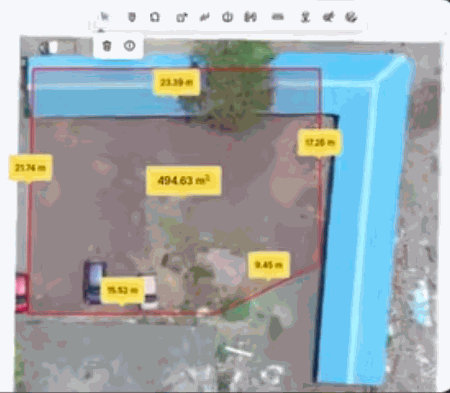
2D MEASUREMENT
Plot boundary and every side length from the drone map
494.63 sq m
TIME-SERIES COMPARISON
See what changed, and when
Compare datasets over time to understand progress, identify changes and maintain date-stamped evidence.
- Swipe and compare layers
- Historical tracking
- Progress evidence
- Construction monitoring
- Encroachment review
3D · DOCUMENTS · PRINT
Go beyond flat maps
Inspect terrain and structures in 3D, take measurements, open supporting documents and print maps.
- Point clouds and meshes
- Height, area and volume measurement
- Built-in PDF viewer
- Map printing
- PDF, CSV, Excel and GIS exports
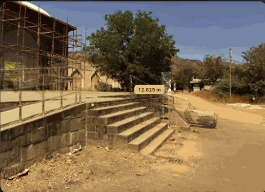
3D MEASUREMENT
Real dimensions of stairs, walls and roads, without a site visit
12.625 m
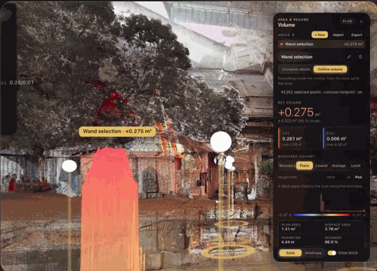
VOLUMES
Its Volume, in one click
Measured from the scan, with a 95% confidence range
0.275 cube m
DATA · SECURITY · AI
Built for drone data — and every other kind
Drone Photogrammetry
GeoTIFF orthomosaics, DEM, DSM and DTM.
OutputsContours, cut-fill and volume.
LiDAR & 3D
Point clouds, 3D meshes and textured models.
Outputs3D viewer, sections, heights and drawings.
Hydrographic
Single/multi-beam echo sounder with RTK GNSS.
OutputsBathymetric surfaces, reservoir capacity and sedimentation.
Thermal & Inspection
Radiometric thermal and zoom imagery for inspection applications.
Vector & CAD
Shapefile, GeoJSON, KML, DXF/CAD, CSV and BIM.
OGC Services
WMS, WFS, WMTS, GeoRSS and scanned maps.
GOVERNED ACCESS
Security and intelligent analytics
Administrators define who can see, edit, download or publish each layer and tool.
Role-Based Access
Permissions by role, layer and tool.
Identity
Strong passwords, MFA and PKI-based SSO.
Data Control
Download restrictions and layer-level edit rights.
Traceability
Logs record who accessed, changed or downloaded data.
Computer Vision
Detect buildings, roads and assets in imagery.
Change Detection
Detect changes and anomalies in imagery.
DEPLOYMENTS
Avlokan in the field
Land Records & SVAMITVA
GIS systems supporting measurement, SVAMITVA mapping and citizen services.
40 Lakh+land measurements
Maharashtra Archaeology
Photogrammetric and LiDAR survey plans for protected monuments and sites.
160+monuments documented across 15+ districts.
Sangli Miraj Kupwad
Drone data capture and processing for flood analysis and disaster management.
1,600+ hectaresof flood-prone area analysed.
Alang Ship Recycling Yard
Drone-and-dashboard monitoring system for docking ships along the Alang-Sosiya coast.
10 km / 600 hacoast and area monitored.
MORE DOMAINS
Built for complex environments
Our Customers
Government

Forest Department, Gujarat State

Maharashtra Industrial Development Corporation (MIDC)
Water Resources Department (WRD)

Rajasthan State Mines & Minerals Limited

Revenue Department, Government of Maharashtra
Uttar Gujarat Vij Company Limited (UGVCL)

CEPT University

The Gujarat Cancer & Research Institute (GCRI)

Gujarat Technological University (GTU)

Benchmark Engineering Inc.

Enersan

IndoSpace
Mahindra Susten
Tata Projects
Takalkar Power Engineers & Consultants Pvt. Ltd. (TPEC)
WindForce Management Services Pvt. Ltd.

Multi Mantech
Enterprise

Reliance Industries Limited
Vyomik Drones
PRODUCT DEMO
See Avlokan in action
Explore how the platform connects survey data, maps, field operations, approvals and decision-making.
WATCH GIS SOFTWARE DEMO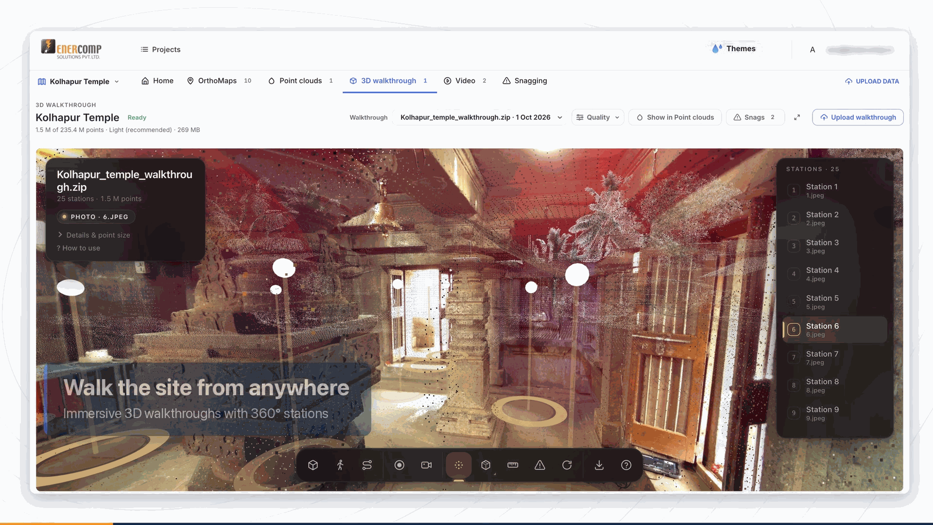
AVLOKAN
Bring location intelligence into your organisation
Talk to Enercomp about your GIS, drone survey, asset mapping or geospatial intelligence requirements.