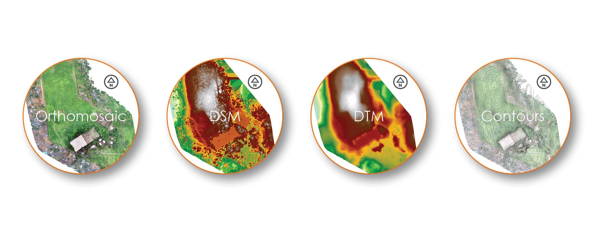
The images were captured in RGB bands. Orthomosaic, DTM (Digital Terrain Model) & DSM (Digital Surface Model) are generated with the help of image processing software with millimeter level accuracy. Further DTM & DSM are used generate contours and other analytical maps. Finally, overlay on Orthomosaic gives us a clear picture of the analysis of the site.
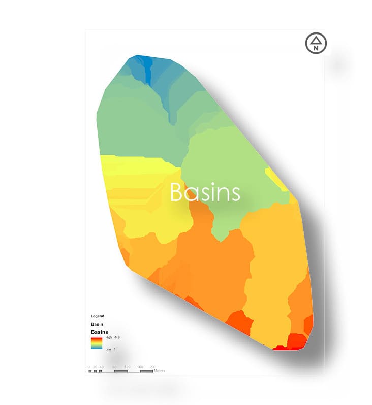
Basin
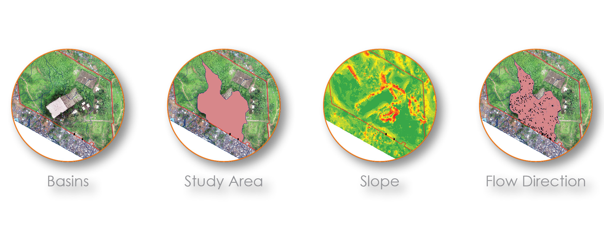
Watershed algorithm helps in the generation of basin. "A basin is the area of land from which all the water flows into a particular river." The basin helps us identify the catchment area for the required points (location).
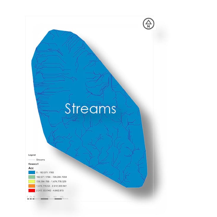
Stream
The post processing of DTM for slope map and direction map and direction map, direction map and demarcation for the direction of the streams. As the slope and direction information is available, the direction of streams are calculated and shown. Further helps in the investigation of water percolation.
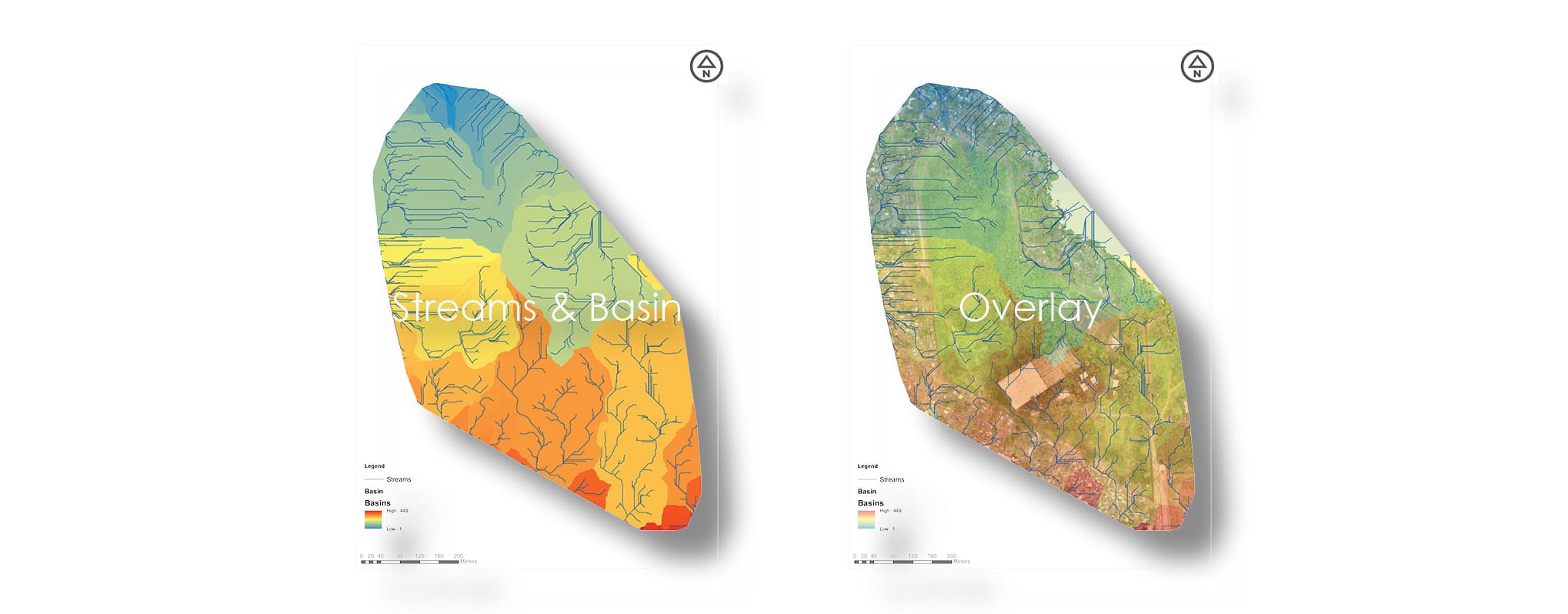
Overlay
Flow Direction
Simulation-1
Simulation-2
Water Accumulation
